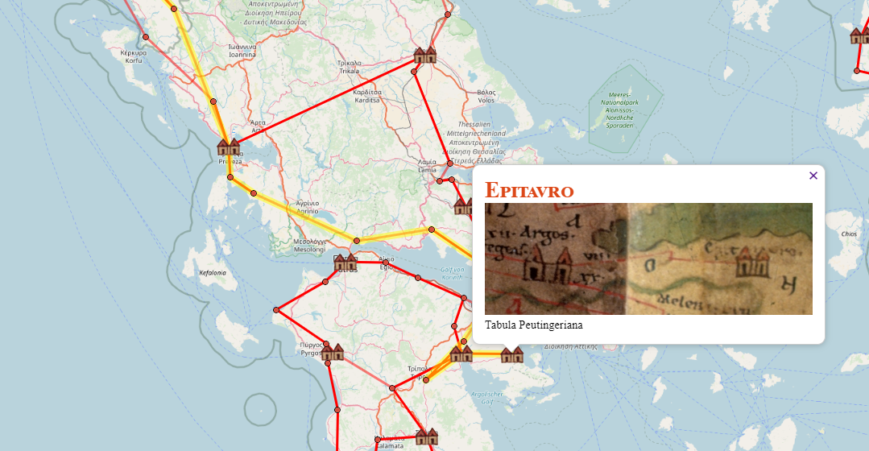
<h3 style="text-align: center;"><strong>Από τη Ρώμη, στο Άργος και την Επίδαυρο.</strong></h3> <h3 style="text-align: center;"><strong>Μια διαδρομή στο οδικό δίκτυο της Ρωμαϊκής Αυτοκρατορίας</strong></h3> <h3 style="text-align: center;"><strong>βασισμένη σε προσομοίωση των χαρτών και των πηγών</strong></h3> <h3 style="text-align: center;"><strong>της Ρωμαϊκής Αυτοκρατορίας</strong></h3> <a href="https://www.cityofnafplio.com/wp-content/uploads/2020/07/Tabula-Peutingeriana_Peloponnesus1a.jpg"><img class="aligncenter size-full wp-image-10751" src="https://www.cityofnafplio.com/wp-content/uploads/2020/07/Tabula-Peutingeriana_Peloponnesus1a.jpg" alt="" width="1911" height="907" /></a> <span style="font-weight: 400;">Σε παλαιότερο άρθρο μας, έχουμε αναφερθεί στον </span><a href="https://www.cityofnafplio.com/2020/09/02/%ce%b7-%cf%80%ce%b5%ce%bb%ce%bf%cf%80%cf%8c%ce%bd%ce%bd%ce%b7%cf%83%ce%bf%cf%82-%cf%83%cf%84%ce%bf%ce%bd-tabula-peutingeriana/" target="_blank" rel="noopener"><b><i>Tabula Peutingeriana</i></b><span style="font-weight: 400;"> (ή </span><b>Peutinger’s Tabula</b><span style="font-weight: 400;"> ή </span><b>Peutinger Table)</b></a><span style="font-weight: 400;">, που αποτελεί μία καταγραφή του οδικού δικτύου της Ρωμαϊκής Αυτοκρατορίας. Ο χάρτης δημιουργήθηκε από έναν μοναχό στο Colmar στη σύγχρονη ανατολική Γαλλία, το 1265. Είναι ένας χάρτης, που δείχνει πολλούς ρωμαϊκούς οικισμούς και τους δρόμους
Επικοινωνία
Located In
Ναύπλιο, Αργολίδας, 21100Mail Us @
cityofnafplio@gmail.com
our page: cityofnafplio


